info@funkytours.com +387 62 612 612

Best Hiking Trails Around Sarajevo - Bosnia and Herzegovina

Hiking Around Sarajevo

There are few areas of the European continent where pure and untouched nature has been preserved in all of its charms and beauty. The most beautiful are the central Bosnian mountains, especially those in the very vicinity of Sarajevo.

From the tame and fertile plains of Northern Bosnia, scenery gradually passes into the hilly and forested plateaus of Central Bosnia. This plateau surrounds Sarajevo on all sides. Because of its special natural position and because of the unusual cultural diversity, speaking from outdoor perspective, Sarajevo is probably the most interesting town in whole of the Balkans.

We bring you the 5 most interesting hiking trails around Sarajevo.

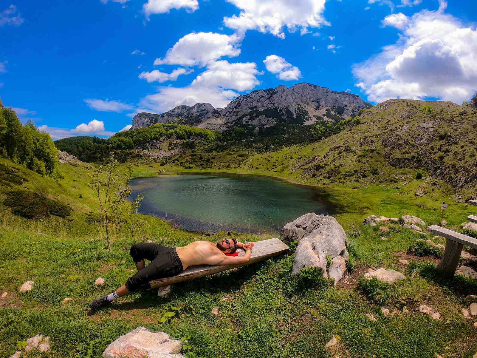
Treskavica mountain with its beautiful glacier lake, called Grand lake.

1. Umoljani to Lukomir hiking trail at Bjelašnica mountain

Located south-west from Sarajevo, Bjelašnica Olympic mountain is crossover between regions of Bosnia and Herzegovina. The mountains natural and cultural diversity is so rich that exploring this Dinaric Alps giant could take you days and days.

Our choice for the best hiking trail on Bjelasnica mountain is trail connecting villages of Umoljani and Lukomir.

The trail starts in Umoljani village (1360m) and via Obalj peak (1896m) takes you to Lukomir village (1450m). The return trail goes via the edge of the amazing Rakitnica canyon, passing through one of the most beautiful valleys in whole of Bosnia and Herzegovina, Cold Creek valley.

Total distance of this trail is cca 15km, and is considered medium challenging.

Once at the Lukomir village make sure to drop by Mina’s place and try some local Bosnian food such as Krompiruša (potato made pie) or Uštipci (plain donuts with local kajmak and cheese).

If you are planning to do this trail on your own, the option to use public transport is to take minibus line #85 from Ilidža to Sinanovići (via Šabići) and exit at the Umoljani village stop. Then take 45min walk to Umoljani village start of the hiking trail. On the way make sure to stop at Stećci necropolis and Umoljani mosque.

If you opt for guided tour, check up Funky Tours Lukomir hiking tour.

Umoljani to Lukomir GPS Trail

Lukomir village is the highest inhabited village in Bosnia and Herzegovina. Located at Bjelašnica mountain on the edge of Rakitnica canyon, this nomad village is perfect escape from city jam into untouched nature. The meaning of the word “Lukomir” as eng. harbor of peace, truly depicts the true nature of Lukomir village.

2. Summit the Trebević Mountain

Trebević mountain rises just above Sarajevo, carrying high up the parts of the city on the left bank of the Miljacka river. Because of its proximity to Sarajevo, as well as because of its beauty, gentleness and easy access, Trebević is the most favorite outdoor destination for Sarajevo citizens.

There are many trails leading up to the Trebević peak, but our recommended hiking route, would be to take one-way Sarajevo cable car and short, 10min walk to Pino Nature hotel, and then, via marked trail through dense pine forest passing by destroyed mountain hut “Vaso Miskin – Crni” via serpentine, arrive at the very top of the Trebević mountain at 1629m.

Walk from the exit cable car station to Pino Hotel is max 10min. Gravel trail goes through pine forest, via stairs, immediately to the right as soon as you get to the parking lot of the cable car station.

Once at the top, you get to enjoy amazing views over the Sarajevo valley and its surrounding giants of Romanija, Treskavica, Bjelašnica and Visočica.

This part of the hike will take you approximately 2.30 hours.

On the return take the eastern ridge trail and visit Jure Franko mountain hut. Jure Franko was Yugoslavian silver ski medallist at the 1984 Winter Olympics in Sarajevo, after whom this charming hut was named.

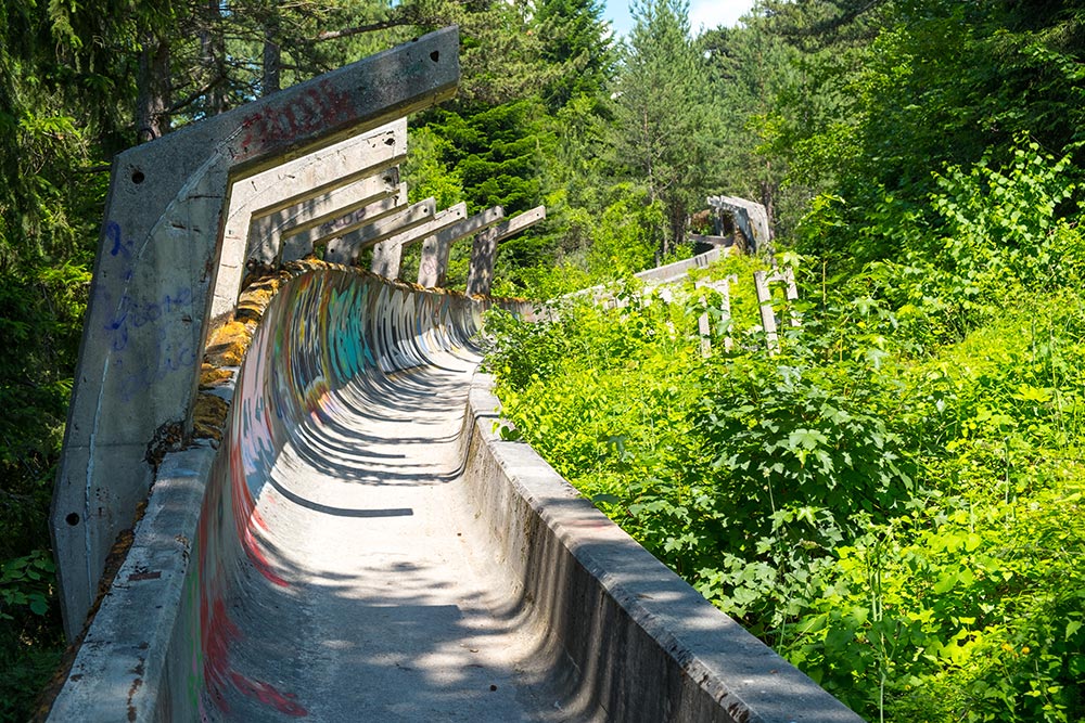
Later take the walk through the Olympic bobsled and via old Sarajevo neighbourhoods of Jarčedoli and Bistrik return to Sarajevo. In this way explore the cultural and natural diversity of this amazing mountain.

Return time would be max 3 hours of easy downhill walk.

Sarajevo Olympic bobsled and luge

The 1984 Olympic bobsled is one of the perfect outdoor destinations just few min away from Sarajevo old town by cable car. If you plan to visit Trebević mountain make sure to walk the whole distance of this mystical wonder, now being overgrown by the vivid vegetation in last 25 years since the end of the Siege of Sarajevo.

One of the most convenient ways to “escape” from Sarajevo to Trebević mountain is via Sarajevska Žičara (eng. Sarajevo cable car). Built originally in 1959., destroyed in 1992 and finally reconstructed 2018., this is one of the most amazing attractions in Sarajevo. For Sarajevo people it is matter of pride.

3. Skakavac Waterfall Hiking Adventure

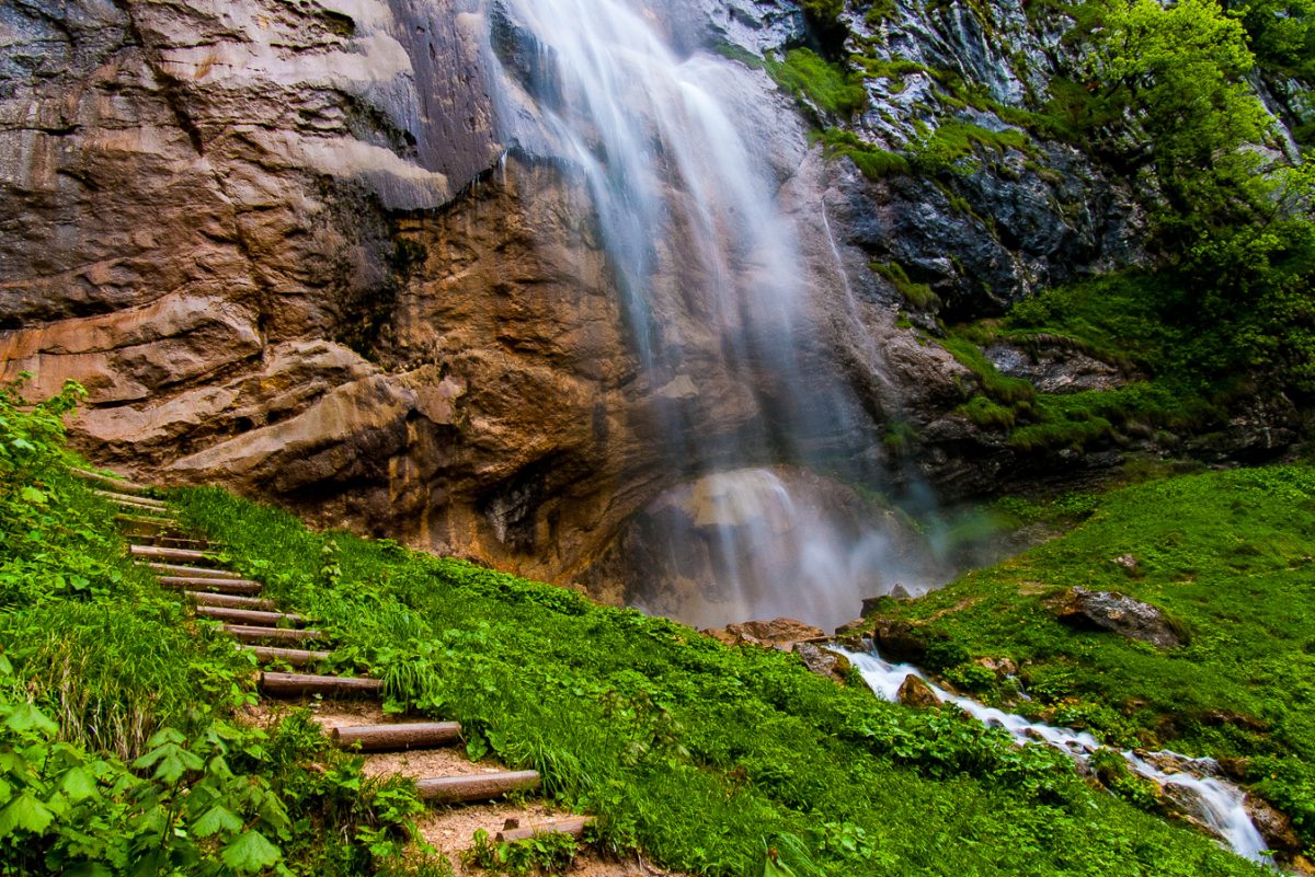
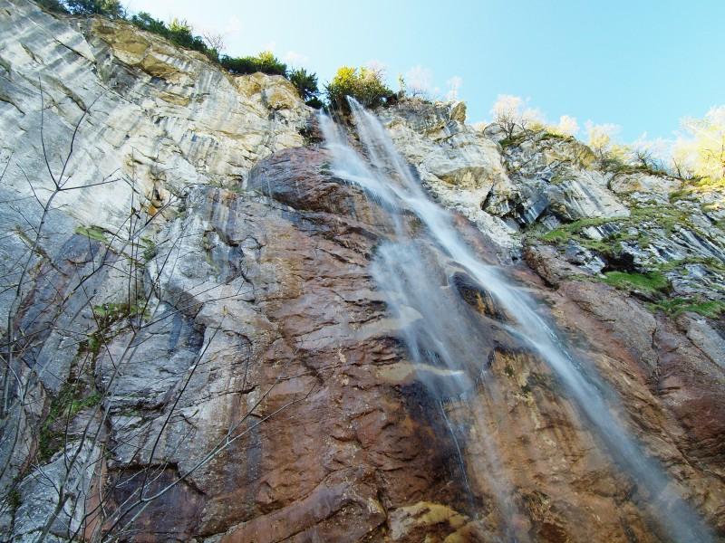
Skakavac waterfall is located 12km north from Sarajevo at Sarajevski Ozren mountain. With its height of 98m, “grasshopper” waterfall is the most amazing natural wonder in the wider area of Sarajevo.

Our most favourite hiking trail towards Skakavac would be to start at Čavljak, and via Crepoljsko and Bukovik access Skakavac waterfall. Most of the trail leading from this direction is gravel road, especially accessible for people with normal to low fitness level.

Starting point at Čavljak can be reached by public transport minibus line #64 from Koševo to Barice with an additional 45 min walk to Čavljak mountain hut. On the other hand, taxi from Sarajevo to Čavljak oneway should not be over 17 to 20 EUR. If you opt to go from this side, your starting point at Čavljak is at 1200+ m.a.s.l., meaning that rest of the trail is slight ascend with majority being easy and relax descend.

Once at the Skakavac make sure to visit the spring just a few min walk above the waterfall itself. When you reach above the waterfall, use the marked serpentine trail to go under it, and enjoy the most beautiful view of the waterfall.

Later, use the marked trail under the waterfall to reach the Dragan’s hut for refreshments or some delicious local food, before you reach Sarajevo city centre by passing through Nahorevo village and Sarajevo ZOO.

In case you decide to take guided tour, please check up Funky Tours Skakavac hiking adventure.

Skakavac Hiking Tour

Skakavac waterfall is 98m high, making it the highest in the Balkans. It is located at the Skakavac Nature Park, only 12km away from centre of Sarajevo. This region is perfect for relaxed outdoor activities, bbq or just relaxing in the untouched nature.

Skakavac Hiking Tour

Best time to visit Skakavac waterfall is the early spring when the falls have the most water, or during the cold winter when the falls are frozen, creating an amazing iced wall, ideal for extreme mountaineer ice-climbing adventures.

4. Visočica - The magnificent high mountain

The meaning of the name Visočica is a “high mountain”. With its highest peaks just under 2000 m.a.s.l., (Vito 1960m and Džamija 1970m) this amazing mountain from the hiking perspective this is one of the most interesting mountains in the wider area of Sarajevo.

Regardless if you are planning to visit this mountain during the winter or summer the hiking and snowshoeing opportunities are limitless. 

Visočica lies in the most eastern part of the Konjic regions. It is sandwiched between the Herzegovinian Zagorje and the high mountain range in the west. It is bordered on the west and north by the river Rakitnica and Tušilački stream, on the east by the stream Ljuta, on the south and southwest by the river Neretva.

Its northern and western slopes descend towards Rakitnica in the vertical and almost impassable slopes, while the southern and eastern parts of its massif, descends slightly into the Bjelemić plateau, which then descends quite steeply into the Neretva valley.

This being said, Visočica mountain ridgeline trail connecting charming, out-of-this world bivouac Zoran Simić, peak Vito (1960m) and peak Drstva (1808m) with Bobovica village, is our most favourite hiking trail.

Most of this medium demanding ridgeline trail offers a constant 360-degree panorama view of the surrounding areas, making this hiking adventure one of the best experiences in all of Bosnia and Herzegovina.

Located on the Via Dinarica trail, at an altitude of 1700+ m.a.s.l., at Visočica mountain, Zoran Šimić bivouac was built by mountain association PD Željezničar and is shelter which can easily fit between 10 to 12 mountaineers. Designed on the design of modern “katun” (eng. summer residence of mountain shepherds) this bivouac is free of charge and is great for nomad-style of overnight stay.

Visočica mountain ridgeline is stunning 360-degrees scenic trail, offering views of the surrounding mountains of Prenj, Bjelašnica and Treskavica with canyons of Rakitnica and Neretva river.

5. Treskavica, the Shaky Mountain

There is no Bosnian mountain where the radical difference between tameness in the vegetation and the karst wilderness, and the bareness is as sharp and as obvious as it is the case with the Treskavica mountain

Stunning lush greenery alternates constantly with sharp rubble and dry bare. Therefore, Treskavica is beautiful and interesting not only for mountaineers, but also for scientists in the field of any natural science.

Heavily rich with numerous streams and creeks, Treskavica mountain is by far the most water-rich Bosnian mountain. Due to its water abundance, people will claim to have easily counted that Treskavica has 365 springs. Imagine, as many days in the year, that many springs on the mountain, including five glacier lakes too.

Stunning hiking trail leading from Turovi village to two of its most amazing glacier lakes, Black Lake at 1680 m.a.s.l. and Grand Lake at 1550 m.a.s.l., is by far our most favorite hiking trail at Treskavica mountain.

If by some chance you decide to take this tour on your own via public transport, make sure to take minibus line #47a from Ilidža to Turovi village, and from there via a marked hiking trail to the Grand and Black lake.

Make sure to note that during the last aggression on Bosnia and Herzegovina, Treskavica mountain has seen intense military activities, and as a result the mountain has been severely mined in certain regions. Marked trail from Turovi to Black and Grand lake is totally safe. However it  is recommended to either take a guided tour or if you decide to follow the trail on your own, make sure to do it without going off the marked trail.

Should you decide that guided hiking tour to Treskavica is your best choice, please consider taking Funky Tours Treskavica Hiking Tour.

Black and Grand Treskavica Lake GPS Trail

Treskavica Hiking - Black Lake

Located at 1680 m.a.s.l., the Black lake is 160 m long, 90 m wide and 5.90 m deep. It’s overgrown with grass and sedge. The black color of the water comes from the moss from the bottom of the lake which is characteristic of glacial lakes.

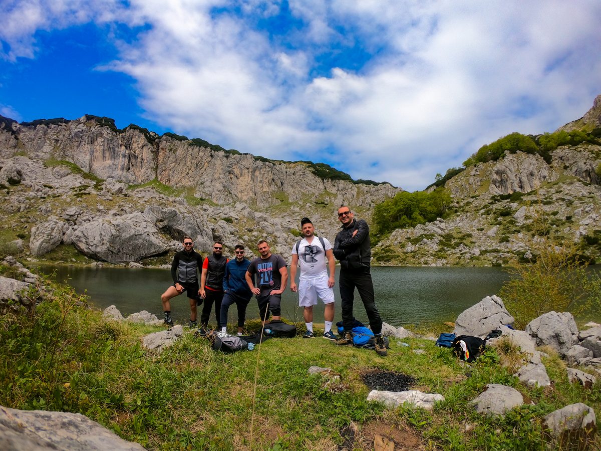
Resting time at the Big Lake - Treskavica Mountain

The Great Lake lies at an altitude of 1548 m. It is oblong in shape, 210 m long, 180 m wide and about 6 m deep. Its eastern shores are lower, so they are overgrown with grass, sedges and marsh plants.

Proceed Booking